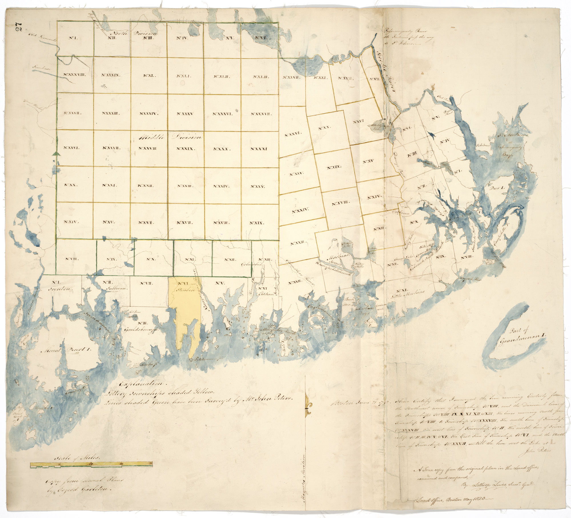
Township Land Maps
In 1783, Massachusetts created a land office and ordered a survey of the territory between the Penobscot and (now) St. Croix Rivers the following year. The Commonwealth sold upwards of 100,000 acres between 1785-86, but it was only a small dent in the approximately 17 million acres of land available. The Commonwealth established a public land lottery covering the inland townships highlighted in yellow (map below) in 1786 to reduce the Commonwealth’s war debt, reduce the individual tax burden, and promote the settlement and improvement of vacant lands. The law carved out fifty townships, each six miles square. They sold 2,720 lottery tickets with an equal number of lots for L60. Lottery participants could win anything from an entire township to a 160-acre lot.
While the lottery did not apply to the (already spoken for) coastal townships, it helps understand the development of the area and requirements for settlement. 320 acres were set aside within each township lot for public use, including establishing a meeting house, minister, and school. The drawing was scheduled in March 1787, but civil unrest in Massachusetts and low demand pushed it back to October, with only 437 tickets sold. The randomly scattered holdings resulted in the “land swap” of 1788, where landholders could exchange prize lots for land in one of five designated townships, but there were few takers.


