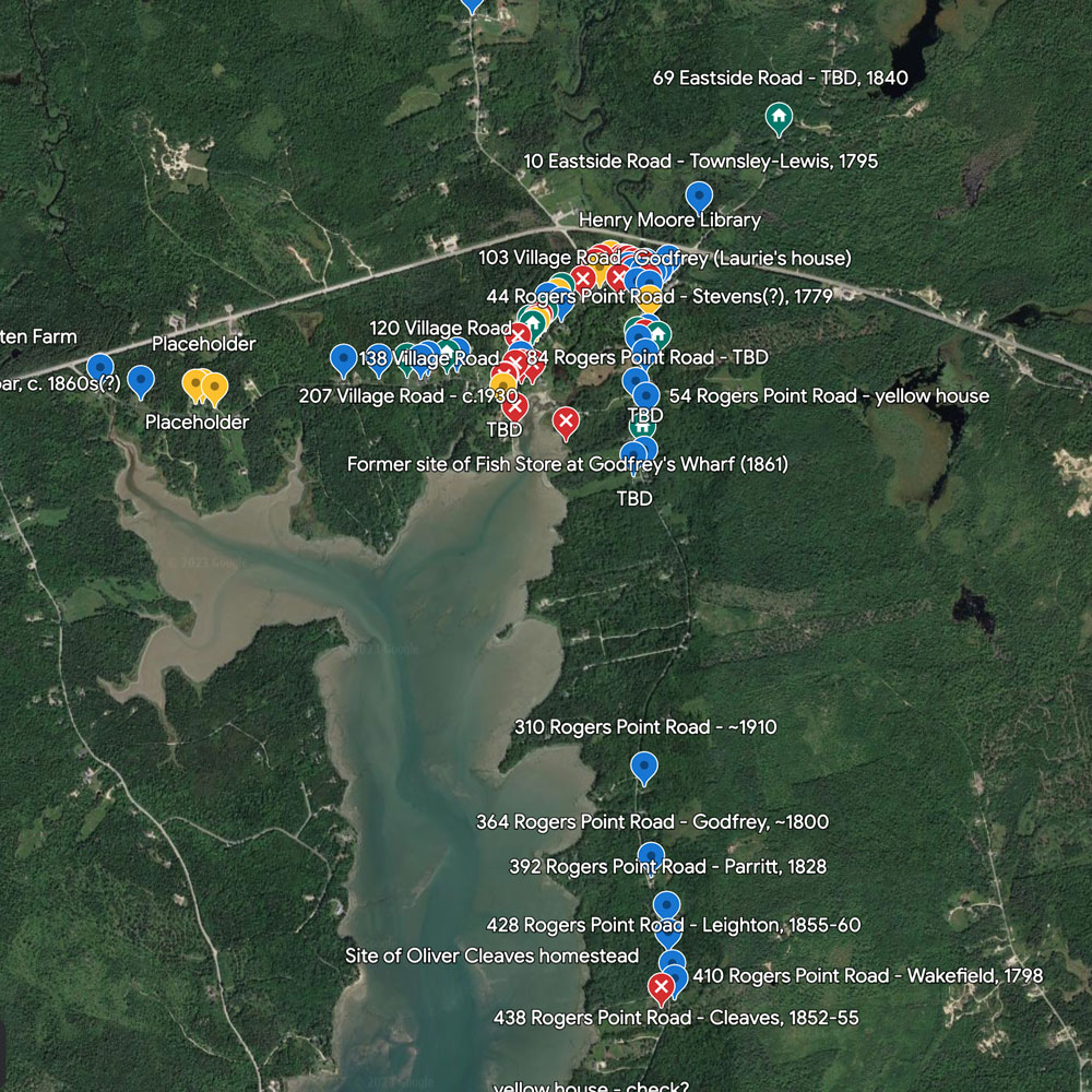
Historic Homes of Steuben on Google Earth
This Google Earth map provides a view of many of the historical structures in Steuben Township. Each marker contains more information on the building, including links to current and historical photographs and property history (where available). Placeholder markers are included for buildings that no longer exist but are of historical interest.
This link will take you directly to the Google Earth site.
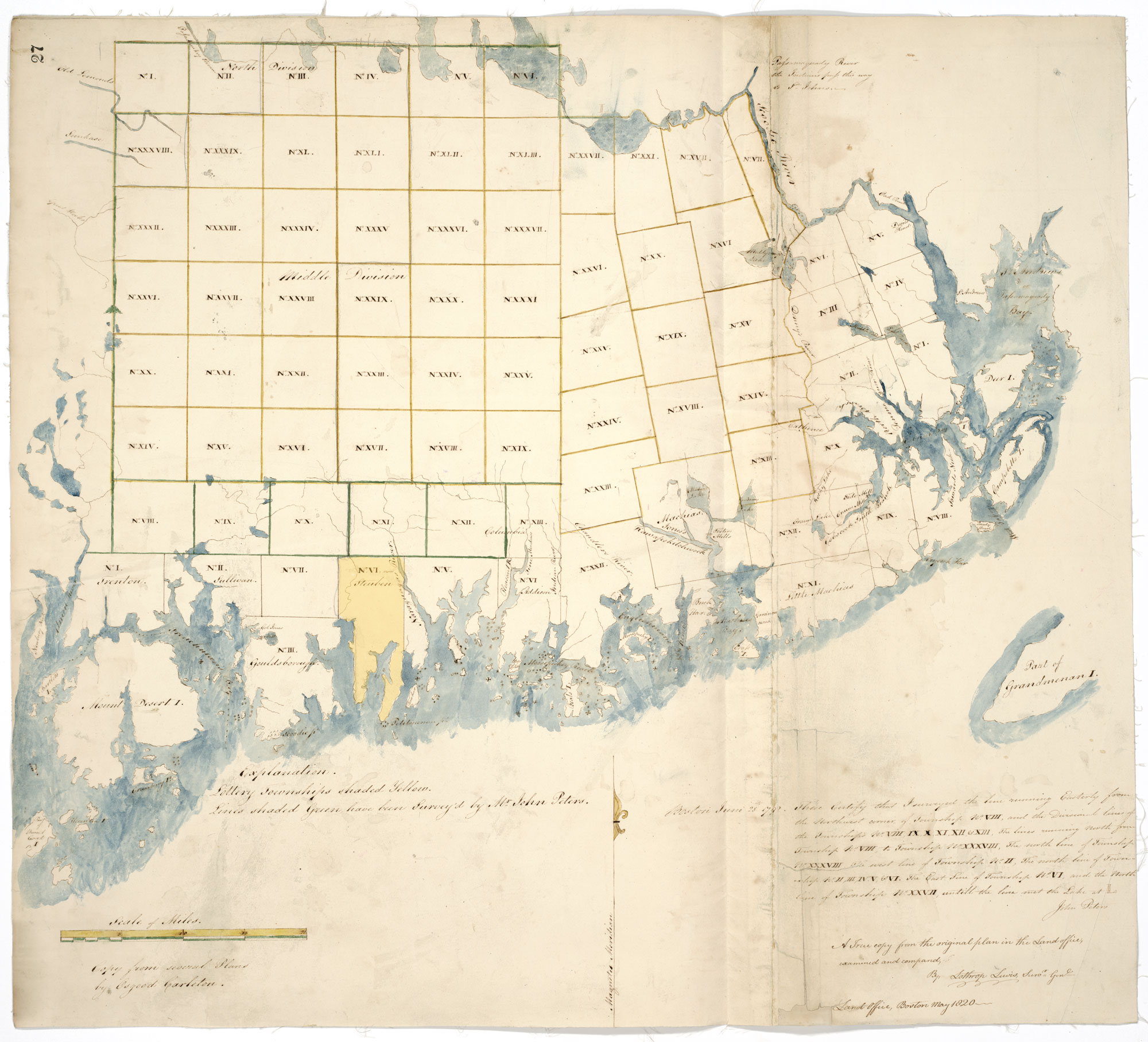
Township Lands East of the Penobscot, Late 1700s
These early maps of land east of the Penobscot show the early boundaries of the township laid out by the Commonwealth of Massachusetts.
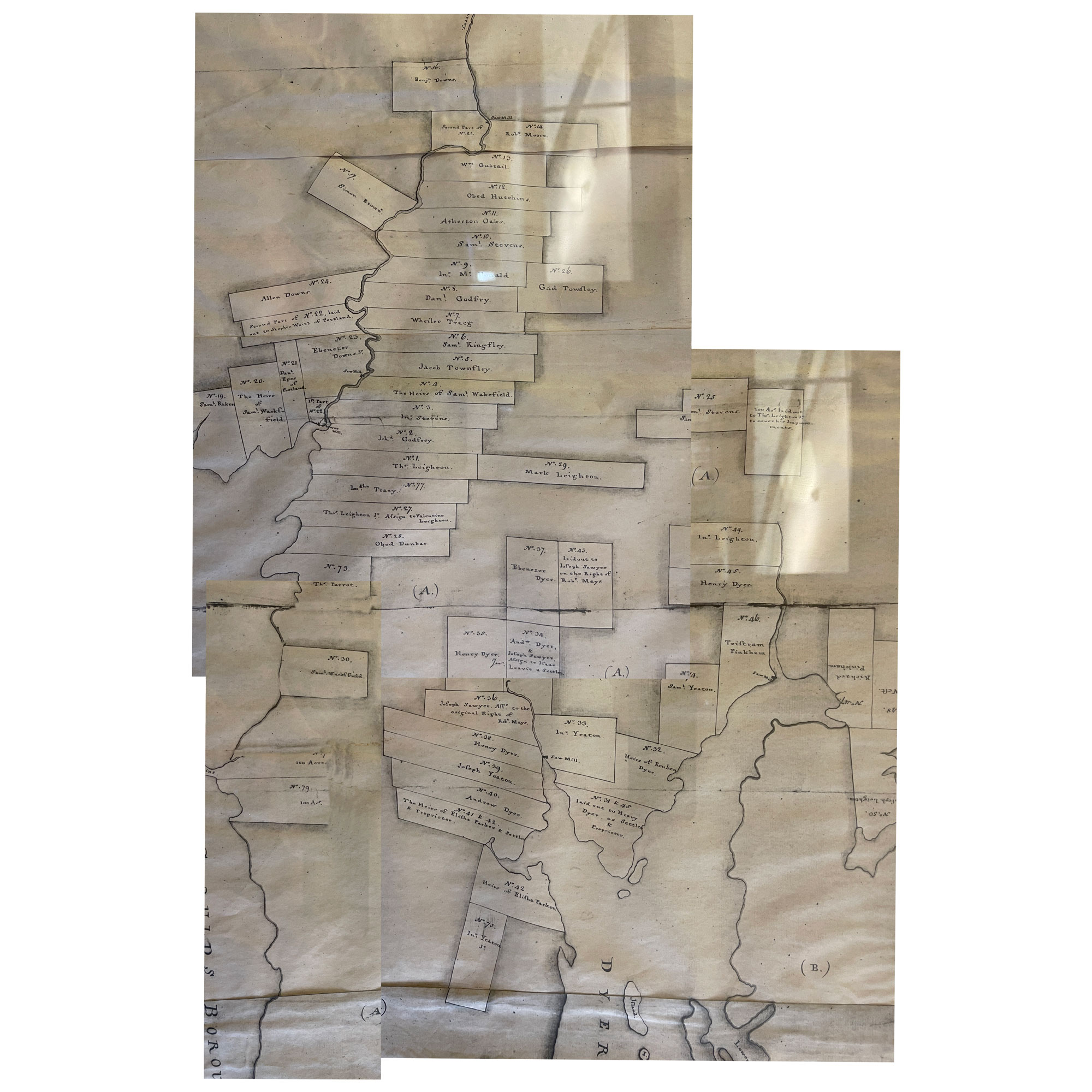
Lothrop Lewis Survey of 1794
The Lothrop Lewis survey establishes the 100-acre lot boundaries for the original settlers of Steuben. Lot boundaries and numbers are used as reference points in property deed documents for the next 200 years. Many of the original boundary lines are still in place today.
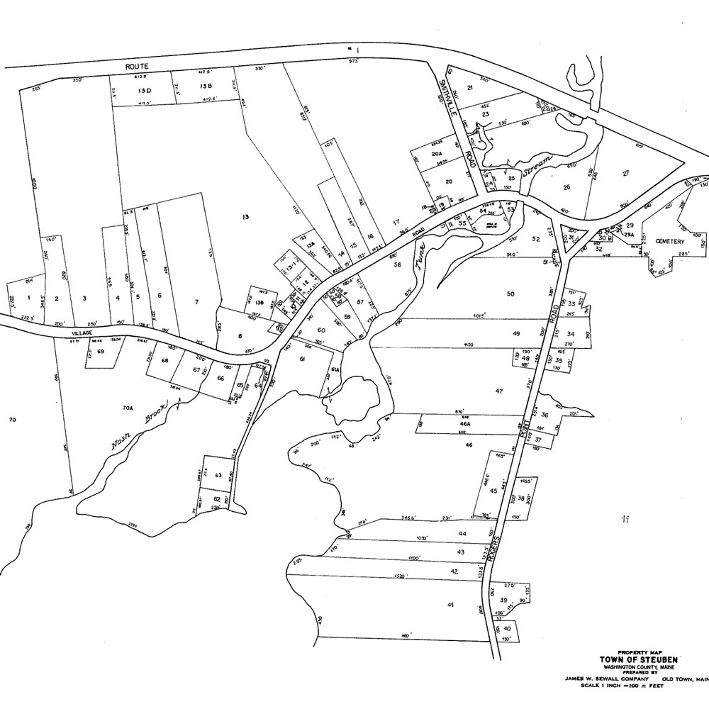
Town of Steuben Tax Assessment Maps
The town tax maps provide the boundaries of the properties and current owners. Current ownership can jumpstart the search for historical ownership of a particular property.
This link will take you to the Town of Steuben tax assessment site.
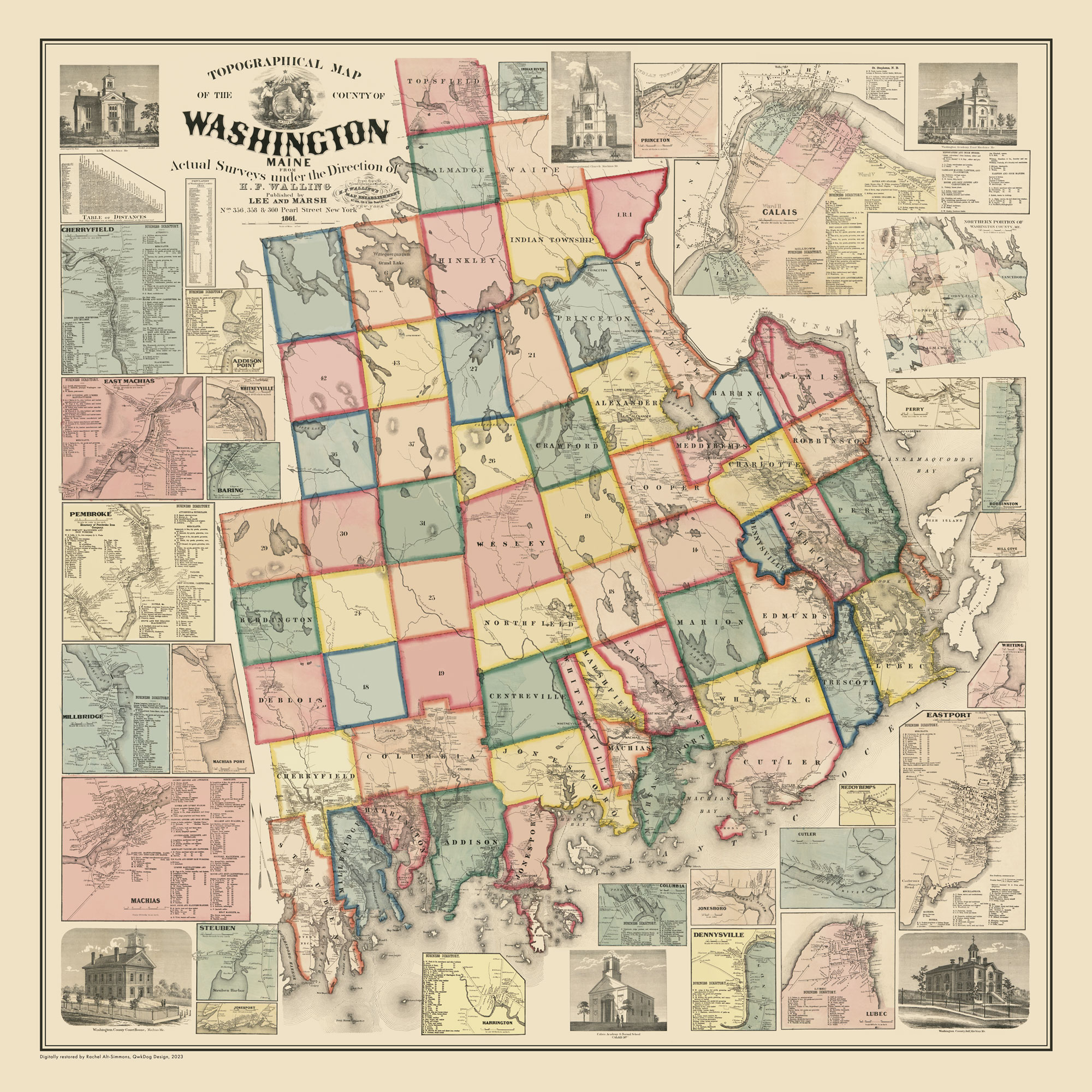
Lee & Marsh Survey Map of Washington County, Maine, 1861
This topographical survey map produced under the direction of H.F. Walling and published by Lee & Marsh of New York City includes structure locations and owner names as of 1861. This map and a subsequent version published in 1881 help establish the lineage of historic homes.
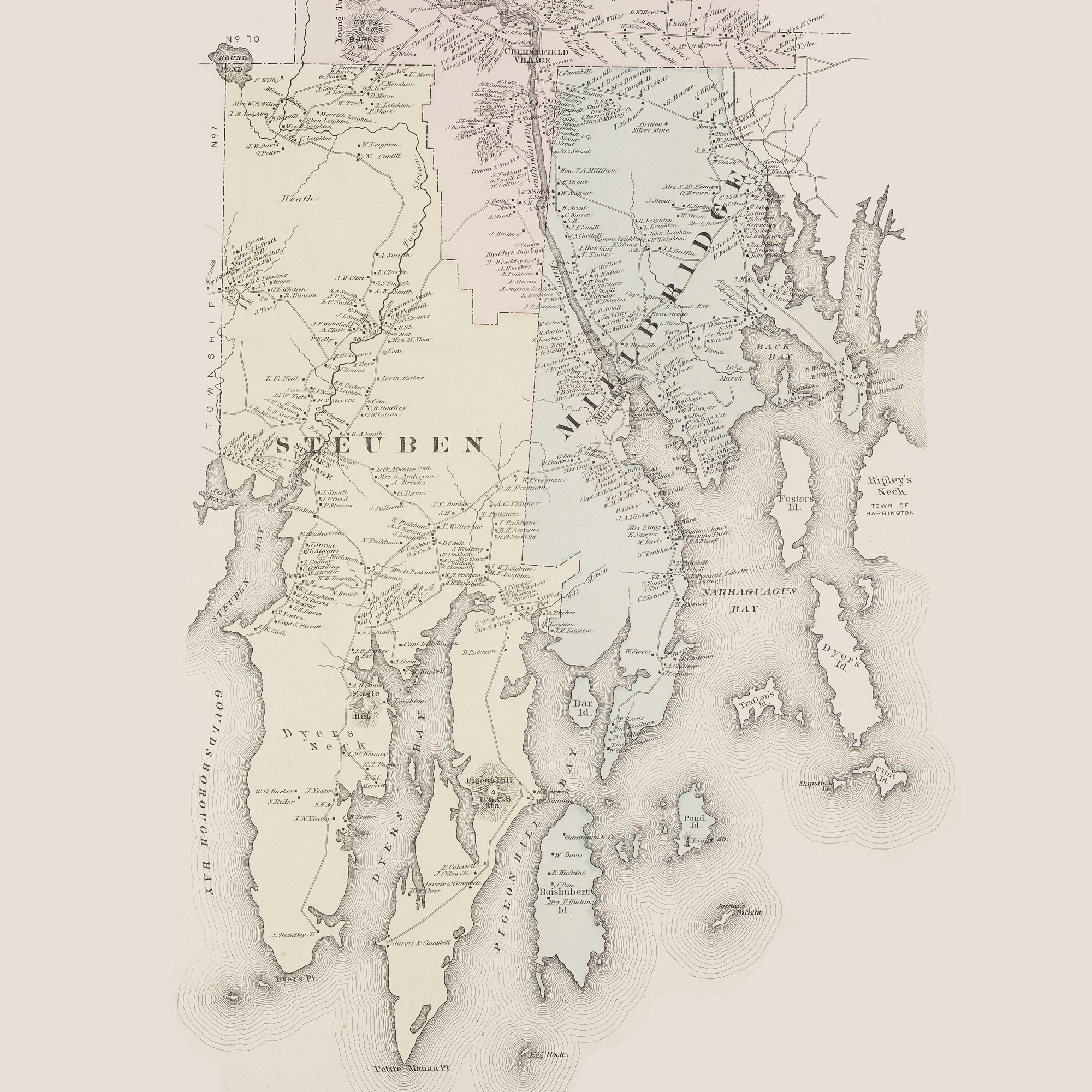
Colby Maine Atlas Maps of 1881
This topographical survey map produced under the direction of H.F. Walling and published by Lee & Marsh of New York City includes structure locations and owner names as of 1881. This map and a previous version published in 1861 help establish the lineage of historic homes.
